An ellipse is a special type of shape that looks like this:

Sponsored Links
You can draw an ellipse if you have a pen, piece of paper and length of string (string which can’t stretch much). What you need to do is first attach each end of the string to the paper somehow (you can always get someone else to hold each end to the paper). It needs to be attached so that there’s a fair amount of slack in the string. The following diagram shows what it should look like from looking down onto the paper:

Next step is to place the pen against the string and then move it outwards until the string is tight, but without drawing on the paper yet:

Now, whilst keeping the string tight, move the pen around until it traces out a complete ellipse. Here’s a diagram showing what your final ellipse should look like, and also showing the arrangement of the string and pen at different times:
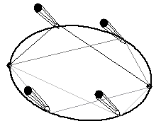
Overlap points of loci
There are lots of practical things that can be done with loci. For instance, say three of your remote island monitoring stations have been hit by a tsunami in the Pacific Ocean. What you need to do is work out how long it’s going to take before it hits the highly populated areas like the coasts of Japan and the USA (as well as everywhere else). The scientists in this particular case know that the wave in the deep ocean is travelling at about 300 km/hr. They also detected the seismic tremor that caused it at 1:10 am in the morning. What is the earliest it will hit the two coasts?
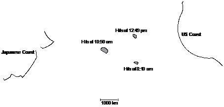
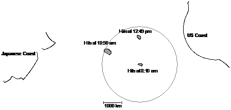
So the wave originates at 1:10 am somewhere in the Pacific Ocean. We don’t know where yet. But we do know that the first island it hits, it hits at 8:10 am. This is 7 hours after the wave started, so we know that it has travelled approximately 7 times 300 km, or 2100 km. So we can draw a circle with a radius of 2100 km around that island to represent all the possible starting points of the wave:
We want to narrow down the location of the wave, so we
need to use information from the other two islands as well. It hits another
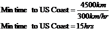
island at 10:50 am, which is 9 hours, 40 minutes after the wave started. This
translates to the wave having travelled a distance of ![]() . So we can draw another
circle around this second island with a radius of 2900 km. This circle
represents all the possible places the wave could have started based only on
when the wave hit this second island.
. So we can draw another
circle around this second island with a radius of 2900 km. This circle
represents all the possible places the wave could have started based only on
when the wave hit this second island.
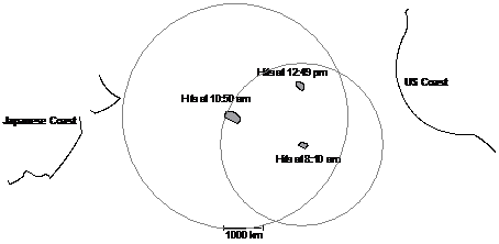
The two intersection points of the circles represent
the only two places the wave could have originated and hit the two
islands at 8:10 am and 10:50 am. We can narrow it down to one place by
plotting the circle for the third island, hit at 12:49 pm. 12:49 pm is 11 hours and 39 minutes after the wave started, which means the wave has travelled ![]() :
:
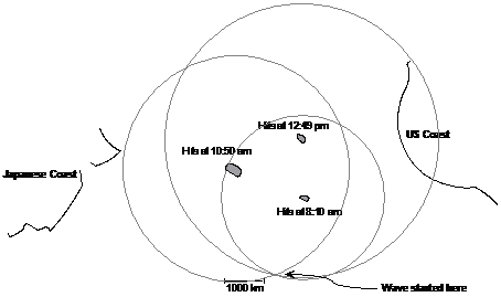
There is only one point where all three circles intersect. This point represents the only place the wave could have started and hit all three islands at the times that it did. So now we know the location where the wave started, we can calculate the earliest times it could hit the two coasts. We can do this by measuring the minimum distance between the wave’s origin location and the two coasts:
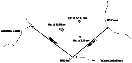

So the wave will hit the US coast no earlier than 4:10 pm, and the Japanese coast no earlier than 5:50 pm. This of course assumes that the wave doesn’t speed up.